|
|
|
|

|
|
03/05/2012
|
My City in BGmaps.com
Since the beginning of March the service “My City on BGmaps.com” has started. You can now create your own account; find out and add useful sites – places for entertainment, shops, medical institutions, company offices etc.; send a message to the municipality or the respective institution concerning irregularities; see the latest information posted by the municipality about forthcoming events, maintenance works and other news.
|
|
|
|
|
|
03/05/2012
|
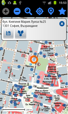
BGmaps for Android
We present to you a free application BGmaps for Android. Using it you can easily and conveniently use maps of Bulgaria and all Bulgarian cities on your mobile phone. With BGmaps for Android you can:
- search for addresses in cities and location of other towns and villages;
- enter quickly an address coupled with autocomplete;
- see on the map where you are located (with a GPS on and/ or wireless network);
- find out useful sites – places of entertainment, ATMs, stops, hospitals, schools, institutions, company offices etc.;
- add sites to the map to be shown to all users, not only in BGmaps for Android, but also in www.bgmaps.com.
In “My places” section you can save places you choose from the map that you can use for personal purposes or to share with others on Facebook, by email etc. In the “My City” section you can send to your municipality messages concerning problems and irregularities. You can also see all information posted by the municipality and the signals sent to it.
|
|
|
|
|
11/25/2011
|
What is new in BGMaps.com
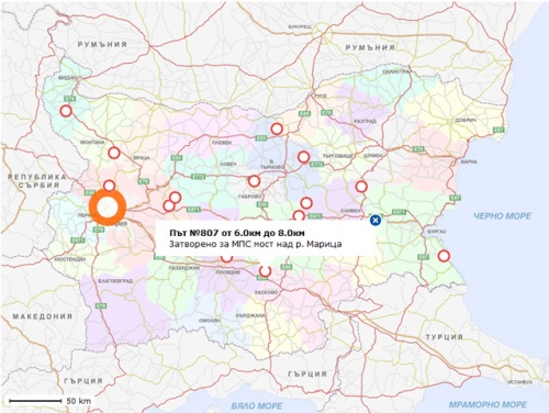
Datecs GIS Center offers detailed maps and data for all 256 towns in Bulgaria, for the 40 biggest towns providing information about more than 278 000 exact addresses. From the middle of November all 256 towns can be seen at www.bgmaps.com in the most detailed scale of the maps 1:5 000. This does not mean that the work connected with the maps and the data base is completed – we are adding all the time new addresses, roads and buildings, we reflect the changes in the names of the streets and boulevards.
Presently the street network comes up to 67 676 km. And the last and latest news is that we offer and maintain updated information relating to the condition of the national road network, provided by Road Infrastructure Agency to the Ministry of Regional Development and Public Works. In bgmaps.com this information is being updated on daily basis and it is always reflected in searching of routes.
|
|
|
|
|
05/27/2011
|
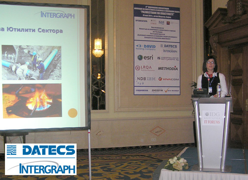
8th National Conference “Innovations in the Energy and Utilities Sector – STRATAgic Shift”
DATECS GIS Center joined the 8th National Conference “Innovations in the Energy and Utilities Sector – STRATAgic Shift” which was held in Sofia on 19th May 2011. The subject of our presentation was “GIS databases, solutions and services for utility companies” and was presented by Stefan Rashkov – Sales and Marketing Manager and Tania Staeva – Project Manager at Datecs GIS Center. The key products presented are:
• Bulgaria INFO-2011 – the best Geographic Database on the market that contains up-to-date data for: complete administrative division of the country; maps of all 255 cities in Bulgaria in scale 1:5,000 with geo-coded addresses for the biggest 40 cities; complete and accurate transport network; rivers, lakes, dams and topographic relief; over 2,100 landmarks.
• The new service of www.bgmaps.com – the initiative “My City”, which gives possibility to municipalities and every utility company to publish on the map of each Bulgarian town information for the planned and current repair works and other activities, as well as to receive signals and feed-back from citizens pointing to the exact position.
• The newest web-based GIS technology of INTEGRAPH.
|
|
|
|
|
03/14/2011
|
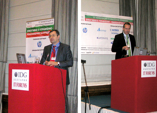
12th Conference on e-governance
DATECS GIS Center, jointly with INTEGRAPH, was partner at the 12th Conference on e-governance “EFFECTIVE E-GOVERNMENT - PROCESS REENGINEERING”, that took place on 10-11 March 2011 in Sofia.
At this conference Datecs GIS Center presented for the first time the initiative “My City” – a new free service of bgmaps.com designed especially for Municipalities. This service will enable each Municipality to use free of charge geographical maps in its web-site. It gives possibility to present on the maps data for planned activities or events, in this way the citizens will be informed more accurately for the processes that take place in their town. At the same time all users of bgmaps.com (over 500,000 unique users per month) will be able with just one click to point out on the map and to send signals for problems or proposals with exact position to the appropriate department in the Municipality of their town.
The initiative was presented by Rossen Russinov – General Manager at Datecs GIS Center.
Robert Nagi – Sales Manager at INTERGRAPH, SG&I for Eastern Europe, presented at the conference GIS standards and solutions of the company Integraph for implementation of the requirements set by Directive INSPIRE.
|
|
|
|
Page 5 from 12: << Previous 1 2 3 4 5 6 7 8 9 10 11 12 Next >>
|
|
|